ROSETTA
REMOTE OBSERVATION and SENSING TECHNOLOGIES and TECHNIQUES IN ARCHAEOLOGY AI enabled humanities
Purdue, the home of astronauts, is a leader in technological innovation. It is at the same time a land grant university, whose mission is to conduct research and educate in the broadest sense and for the most diverse intellectual and professional paths. ROSETTA - Remote sensing technologies and techniques in archaeology - is a new initiative that will create new frontiers of interdisciplinary research by combining the strengths of our remote sensing, computational, and socio-humanities scholars, which impacts that will resonate far beyond the walls of Purdue.
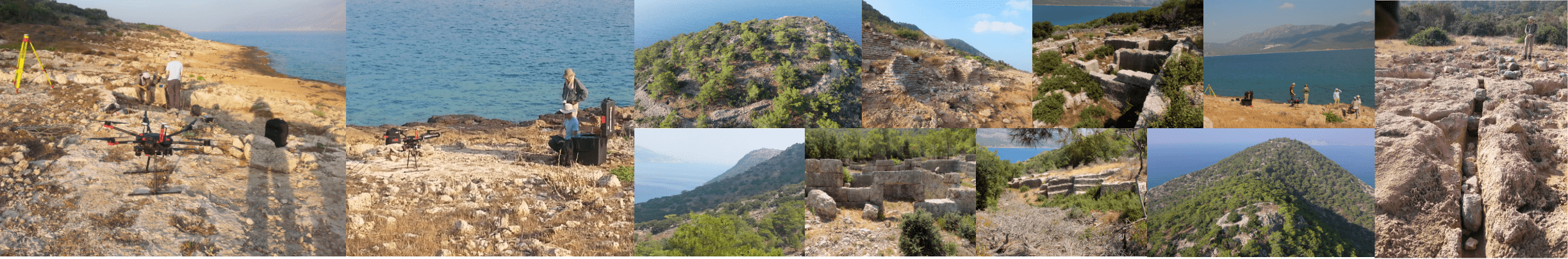
The world’s archaeological sites comprise a non-renewable treasury of not just shared global heritage, but also vital data for studying how ancient human societies responded to the familiar challenges of environmental change, food scarcity, technological transformation, and warfare. Many of these valuable heritage resources are threatened by climate change, urban development, and regional conflicts, leading to intensified efforts by national and international research and conservation stakeholders to document and preserve them. Airborne remote sensing has been an indispensable technology for locating archaeological sites since the earliest aerial photographs from hot-air balloons demonstrated that traces of ancient human occupation on the landscape can create subtle features (such as crop marks, soil marks, and shadow marks) that are only visible when viewed from above. The recent proliferation of affordable remote sensing technologies—e.g. geophysical survey, drone-derived imagery, Light Detection and Ranging (LiDAR), and satellite data—has led to a deluge of spatial data being collected at both known and prospective sites. However, a lack of adequate cyberinfrastructure (CI) for researchers to manage the collected data and build and evaluate robust computational models for automated site discovery and assessment has so far precluded the effective utilization of the collected data.
ROSETTA addresses this bottleneck by assembling Purdue’s diverse expertise in the fields of archaeology, geomatics, machine learning, and cyberinfrastructure in developing an open-source, publicly accessible computational archaeology CI for spatial data management, automated site discovery, and visualization. The computational tools of ROSETTA will be built around Purdue’s MyGeoHub CI platform and the NSF DIBBs-funded GABBs geospatial software building blocks. The ROSETTA CI will be the first public-facing platform for computational archaeology allowing users to contribute, manage, and analyze remote sensing data for archaeological discovery. In addition, ROSETTA will train the next generation of cutting-edge practitioners in the rapidly expanding field of computational and digital archaeology through undergraduate and graduate level spatial analysis courses and research fellowship opportunities. We envision ROSETTA as a locus for innovative archaeological research, education, and engagement.