
OPMAPS
OPMAPS
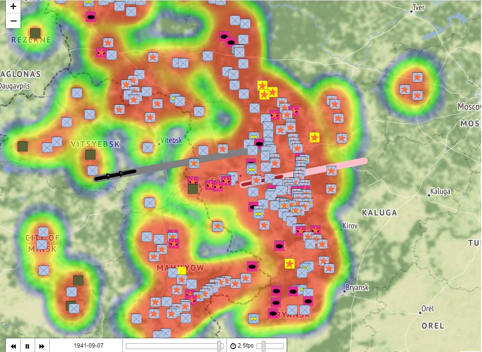
Operational Mapping and Analytics (OPMAPS) is a multidisciplinary project at Purdue to digitize historical and contemporary military maps and to create new methods of statistical analysis. The interactive opmaps facilitate interpreting military operations retrospectively and prospectively. The OPMAPS analytic tools identify main flows of movement, points of most likely attack, or most likely points for a breakthrough while highlighting the logic of battle, the missed opportunities and the degree to which a battle was won by sheer force or by its skillful use. Chiefly using primary source materials, OPMAPS makes highly detailed editable, manipulable and query-able animated maps to assist civilian and military teachers and scholars convey this complex subject matter.
The project is the product of a close collaboration between FORCES Founder Sorin Adam Matei, PhD, an expert in spatial social statistics and Robert Kirchubel, PhD, a widely published author of World War II operational military histories.
To learn more about OPMAPS, contact Kirchubel at rkirchub@purdue.edu or Sorin Adam Matei at smatei@purdue.edu.
Video of an OPMAP animated maps: the battle of Somlensk, July-August 1941. Fully interactive versions will be available soon.